A look inside.
The chat assistant and the 3D globe, working on real BIM + GIS data.
Screenshots from a development build. Want to see it run on your own data? Get in touch.
Geoxide is an embeddable AI assistant that connects to your building models, GIS layers, and maps and understands them — so you can ask questions in plain language and watch the answers light up on a live 3D globe.
A technology preview — no public demo running right now. Want a live walkthrough? Reach out.
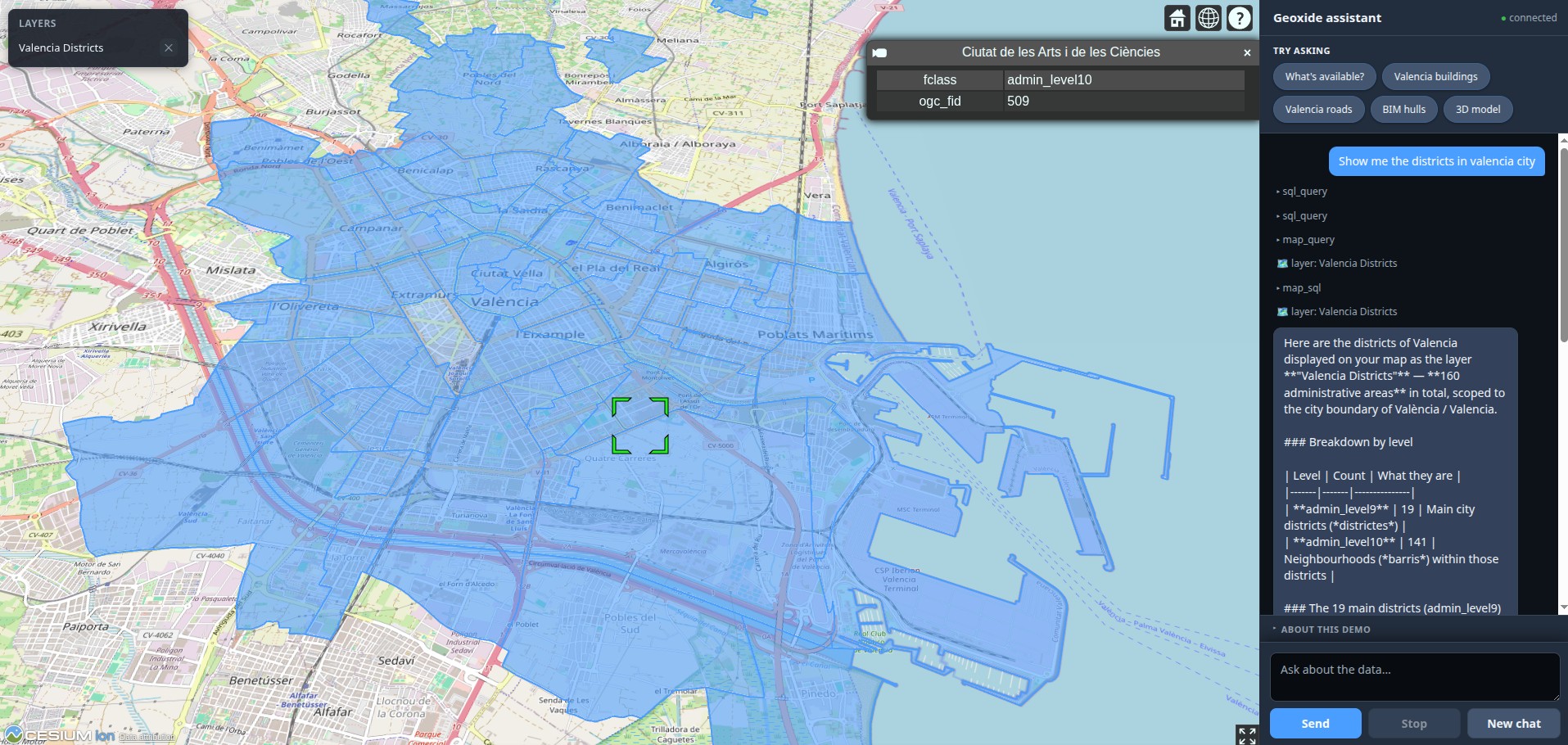
One question. Your answer. On the map.
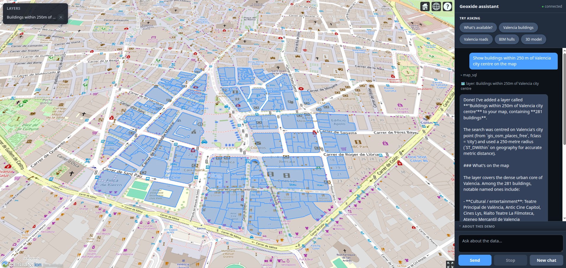
Type questions the way you'd ask a colleague. No query languages, no GIS expertise, no training required.
Answers don't just appear as text — they light up as layers and 3D models on a live map, so you instantly see the where, not just the what.
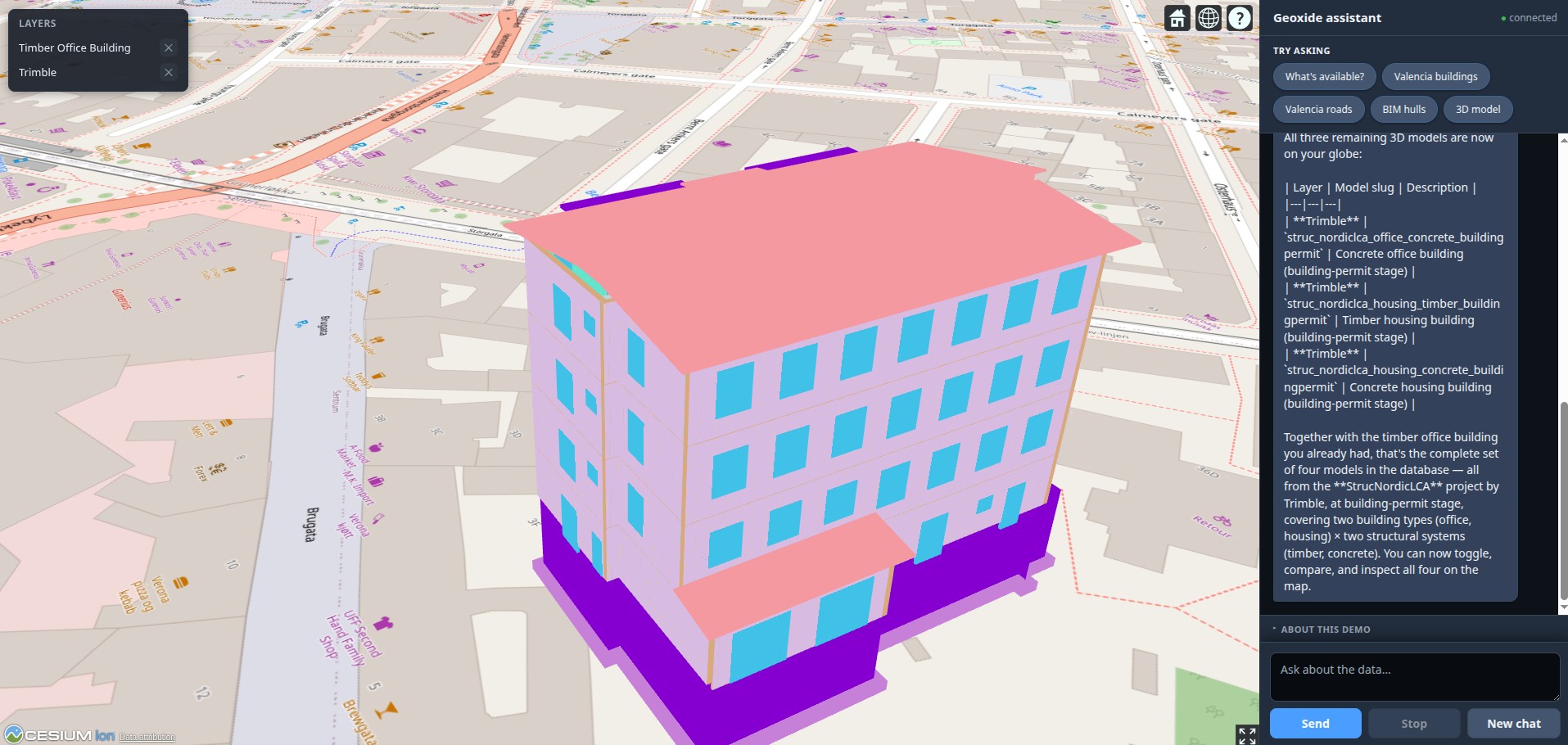
Building models and geographic features, unified. Ask questions that span both — floors, walls, parcels, roads, utilities — all at once.
The chat assistant and the 3D globe, working on real BIM + GIS data.
Screenshots from a development build. Want to see it run on your own data? Get in touch.
Built from the ground up in Rust — embeddable, render-independent, and provider-agnostic.
An async Rust agent does tool-calling over your data — SQL, spatial queries and semantic search — turning a plain-language question into a precise answer.
A bespoke LOD globe renderer built on Bevy + WebGPU, with floating-origin precision. Compiles to a Cesium-like wasm/JS library you can drive from any web host.
Industry-standard IFC files are parsed, georeferenced, and exported to 3D meshes — query rooms, walls, beams, columns and slabs by name, type or property.
Geographic features and embeddings live in PostGIS. The agent connects with a strictly read-only role — your data stays where it is, never copied or migrated.
TypeScript and Rust SDKs over a shared wire protocol — token streaming, typed map actions, reconnect. Drop the chat into your own app and map renderer.
Designed to run on-premise, inside your own environment — your data never leaves it. Bring your own AI provider: Anthropic Claude, any OpenAI-compatible API, or local models.
I'm Rafael Gaitán — a software engineer specialised in 3D graphics, geospatial systems and real-time rendering, with two decades building high-performance visualization and simulation software. Geoxide is my take on what a modern, AI-native interface to BIM + GIS data should feel like: fast, embeddable, and honest about where your data lives.
Every layer here — the agent, the IFC pipeline, the spatial backend and the custom WebGPU globe — was designed and built end-to-end in Rust. I'm available for consulting and freelance work around 3D/geospatial visualization, rendering engines, and AI-assisted data tooling.
Interested in Geoxide on your own data, or in working together? I'd love to hear from you.